RS_PixelAsPoint
Introduction: Returns a point geometry of the specified pixel's upper-left corner. The pixel coordinates specified are 1-indexed.
If colX and rowY are out of bounds for the raster, they are extrapolated assuming the same skew and translate values.
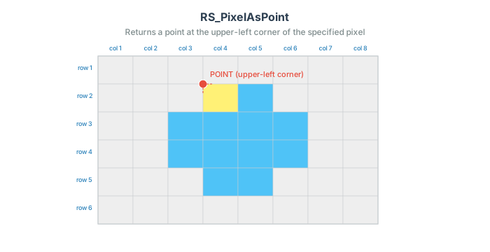
Format: RS_PixelAsPoint(raster: Raster, colX: Integer, rowY: Integer)
Return type: Geometry
Since: v1.5.0
SQL Example
SELECT ST_AsText(RS_PixelAsPoint(raster, 2, 1)) from rasters
Output:
POINT (123.19, -12)
SQL Example
Out of the grid, the coordinate is extrapolated rather than rejected. The raster below is 5 pixels wide, so column 6 is the first column past its right edge, and that column's upper-left corner lies on the edge itself (x = 123 + 5 × 8 = 163):
SELECT ST_AsText(RS_PixelAsPoint(RS_MakeEmptyRaster(1, 5, 10, 123, -230, 8), 6, 2))
Output:
POINT (163 -238)