ST_InterpolatePoint
Introduction: Returns the interpolated measure value of a linear measured LineString at the point closest to the specified point.
Note
Make sure that both geometries have the same SRID, otherwise the function will throw an IllegalArgumentException.
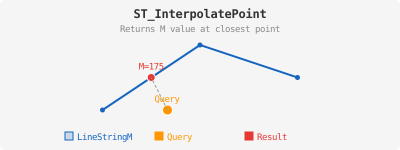
Format: ST_InterpolatePoint(linestringM: Geometry, point: Geometry)
Return type: Double
Since: v1.7.0
SQL Example
SELECT ST_InterpolatePoint(
    ST_GeomFromWKT("LINESTRING M (0 0 0, 2 0 2, 4 0 4)"),
    ST_GeomFromWKT("POINT (1 1)")
    )
Output:
1.0